
Z-SCAN: Full-scale drone detection and airspace awareness.
Z-SCAN is built for organizations that need continuous or rapidly deployable visibility into the airspace above and around their facilities, from public-safety agencies to airports to critical infrastructure sites.
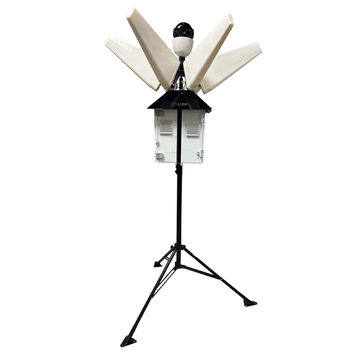
One deployable system, from antenna to dashboard.
Z-SCAN connects long-range detection hardware directly to the Zing Airspace Platform, so your team sees aircraft the moment they're detected, without managing separate systems.
Long-Range External Antennas
Wi-Fi, Bluetooth, and configurable additional radio coverage
Receiver Hardware
Captures Remote ID and configured signal types
Onboard Computing
Processes detections and manages local device state
Cellular / Network Communications
Secure transmission to the Zing Airspace Platform
Cloud Dashboard Connectivity
Live map, geofences, alerts, and historical logs
Published performance figures.
- RID detection range
- 10 km
- Location accuracy
- ±1 m / ±1°
- Frequency coverage
- 600 MHz – 6 GHz
- Operating temperature
- -20°C to 50°C
Take the documentation with you.
Spec sheets and reference material for Z-SCAN, free to download and share with your team.
Where Z-SCAN is running today.
- Oregon Department of Corrections (multiple facilities)
- Salinas Airport, California (air taxi test flight security)
- La Selva Beach drone testing facility (air taxi testing)
What Z-SCAN does.
Wi-Fi and Bluetooth Remote ID detection
AI optical recognition as a redundant layer for non-broadcasting aircraft
RF fingerprinting of common control protocols
Live drone location on a 2D and 3D map
Operator and control-station location, including RF triangulation and trajectory back-tracking
Turn-by-turn routing from responder to operator position
Geofence monitoring with configurable zones
Text and system alerts
Aircraft whitelisting for known, authorized operators
Encrypted forensic logging for investigation and prosecution
Historical activity logs and evidence capture
Long-range external antennas
Fixed installation or portable hard-case configuration
Cloud-connected management interface
Built for the teams responsible for the airspace.
Published range and accuracy figures reflect spec-sheet performance. Real-world results depend on the environment, antenna configuration, installation height, radio conditions, and the transmitting aircraft. Z-SCAN is a passive detection system. It does not jam, disable, capture, or take control of any aircraft.
Where Z-SCAN is deployed.
Common questions about Z-SCAN.
Z-SCAN detects Wi-Fi and Bluetooth Remote ID broadcasts from compliant drones out to a spec-sheet range of 10 km, and adds AI optical recognition and RF fingerprinting to catch homemade or deliberately non-broadcasting aircraft. It identifies the aircraft and locates the operator, either from the Remote ID broadcast directly or through RF triangulation and trajectory back-tracking.
Z-SCAN reliably detects drones broadcasting compliant Remote ID signals, and layers AI cameras, RF fingerprinting, and optional acoustic sensors to cover non-compliant aircraft. No single sensor technology detects every possible aircraft in every condition, which is why the system is built around redundant layers.
No. Z-SCAN is a passive detection and awareness system. It does not jam, disable, capture, or take control of any aircraft, which is precisely why it can be deployed at prisons, hospitals, and airports where jamming would disrupt critical communications, medical equipment, and aviation systems.
Intercepting a single aircraft does nothing if the operator can immediately launch another. By giving law enforcement the operator's GPS position and live routing to it, Z-SCAN enables apprehension, prosecution with forensic evidence, and lasting deterrence rather than a temporary interruption.
Z-SCAN installs as a fixed base station for permanent sites and also ships in a portable hard-case configuration with long-range external antennas. It connects to the Zing Airspace Platform over the cloud for live monitoring and historical review.
Get Started
See Z-SCAN in your environment.
Request a demo to see how Z-SCAN detects, maps, and alerts on drone activity above your facility.